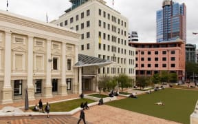
Wellington's Municipal Office Building (the tall cream coloured building in the middle) sits next to the Town Hall (left) in Te Ngākau Civic Square. Photo: Supplied/ Wellington City Council
Wellington City Council is hopeful, based on new modelling, that buildings in Te Ngākau Civic Square will be fine in a big flood - but that could be up-ended by fresh climate change data.
Engineers have modelled the impacts on the Town Hall, central library, Michael Fowler Centre and other buildings in the square, where rebuilds are already underway and redevelopment options being looked into.
"Based on our initial assessments, the flooding and sea level rise will not have an impact on existing or future buildings, except the basement," the council told RNZ.
However, the climate change data modelled with is several years old.
The short report said: "Any future flood modelling in this area will need to take into account updated guidance on climate change allowances".
"This is likely to significantly worsen the flooding predicted in this study."
The study also does not take into account the basements.
Fitting out the basement of the Town Hall has become a major factor in skyrocketing costs at its rebuild, and this and the library's seismic strengthening are putting immense strain on council finances.
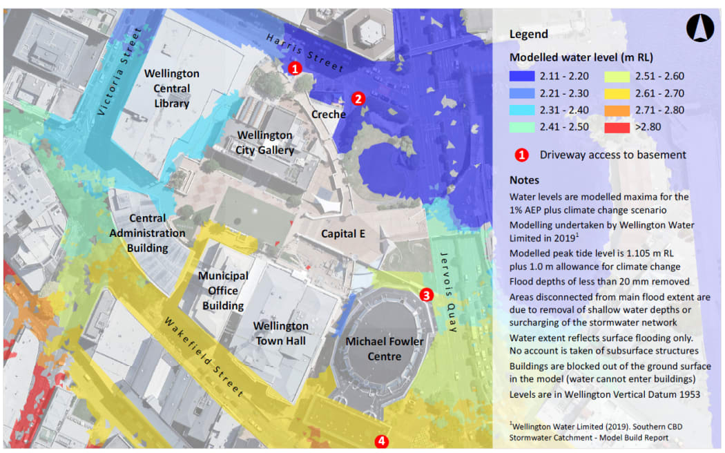
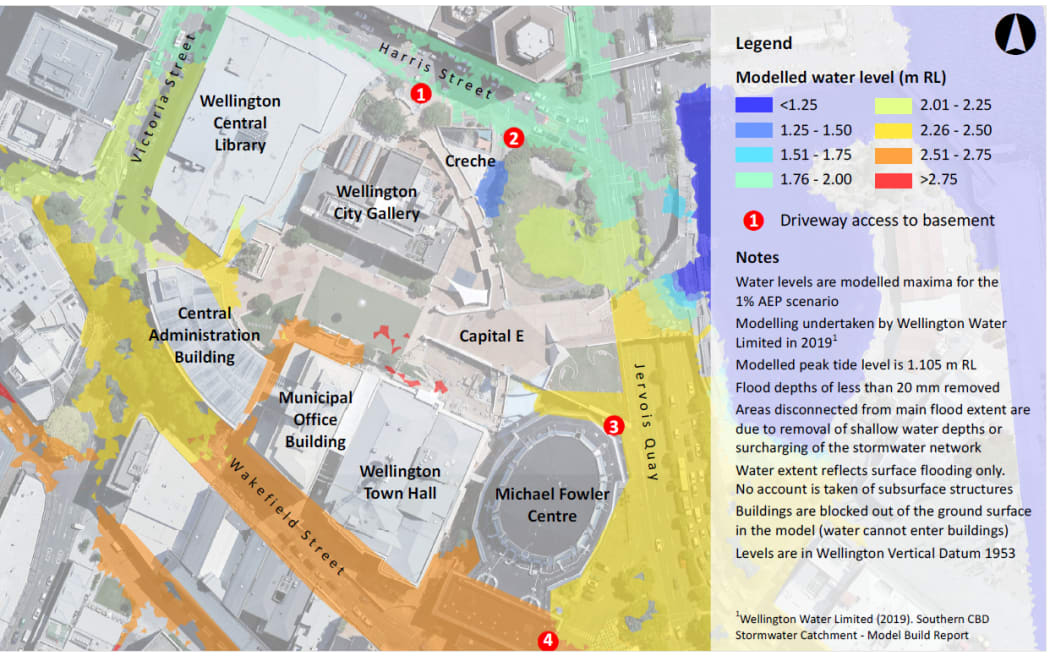
Modelling showing Te Ngākau Civic Square flood water levels with climate change factored in. Photo: Supplied / Wellington City Council
The new study foresees floodwaters rising above the ground level access at between two - without factoring in climate change - and four buildings with climate change, in a real deluge.
"This indicates that water may enter the affected buildings and the basements in this scenario," it said.
Mitigating could be looked into, it recommended.
The water at the Town Hall could get to 2.6m higher than a reference point around mean sea level, and 2.2m in surrounding streets, in major floods.
In a third, less-severe scenario, floodwaters pooled in just a handful of spots.
"In all scenarios, the flood extents are likely a combination of surface runoff accumulation from the wider catchment and surcharging from an overwhelmed stormwater network," the study said.
Modelling showing Te Ngākau Civic Square flood water levels without climate change factored in. Photo: Supplied / Wellington City Council
It recommended checking with Wellington Water about how much stormwater might overflow and where.
The council should also update the climate change assumptions "to understand the likely increase in risk this presents to development in the precinct".
The council has just issued a tender for ideas to redevelop its two administration blocks in the square.
"As indicated in the report, a more detailed investigation is required," the council said.
"The consultants are producing an accurate model of the precinct with its basements to assess the behaviour of water and flooding under different scenarios.
"We are also assessing the impacts of climate change on flooding and sea level rise further, alongside considering all the mitigation tools to address any issues we may encounter regarding climate change, flooding or sea level rise. We are expecting to conclude these studies by early next year."