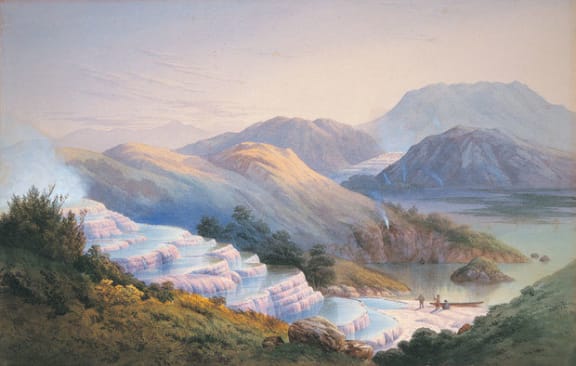

Painting of the Pink and White Terraces by John Hoyte. (Otago University)
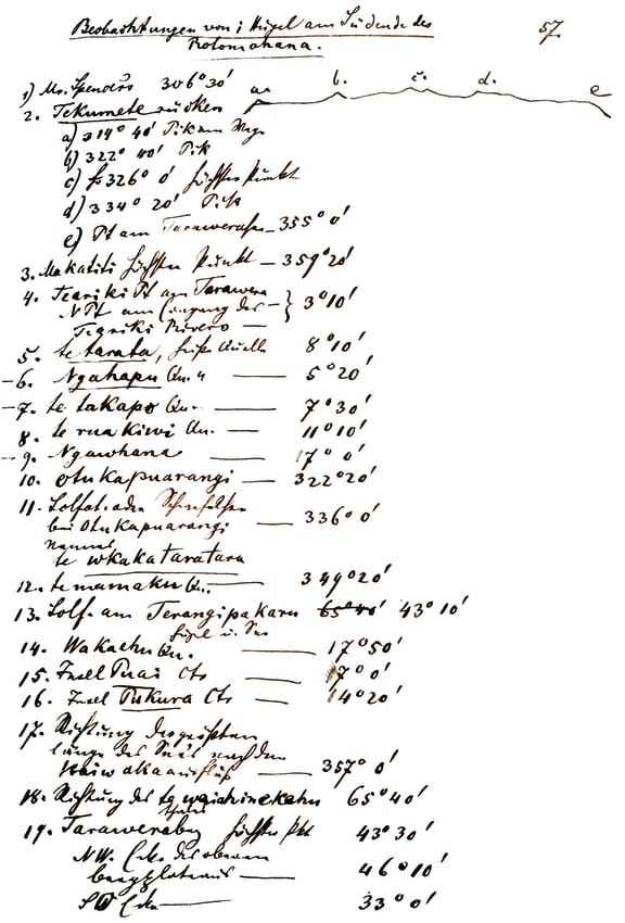

A page of old Lake Rotomahana compass bearings from Dr Ferdinand Hochstetter’s field diary from April 1859.
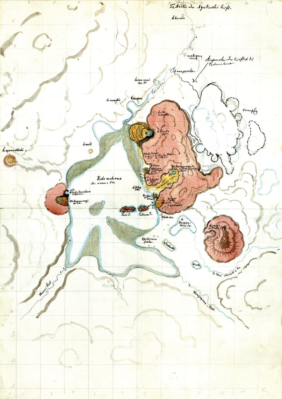

Hochstetter’s method-of-squares map discovered by Dr Sascha Nolden in Basel in 2010, and vital in discovering terrace locations.
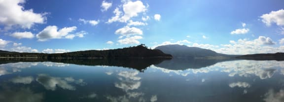

A Lake Rotomahana panorama from the 2016 lake dive, taken from near Hochstetter’s stations 21 and 22. This photo was crucial in establishing Hochstetter’s master-bearings from Koa on Mt Tarawera.
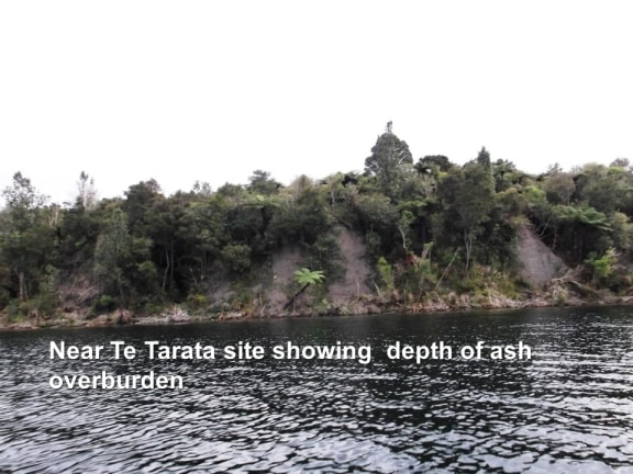

Taken on approach to Te Tarata site area, showing the rough country and deep ash overlaying the search areas.
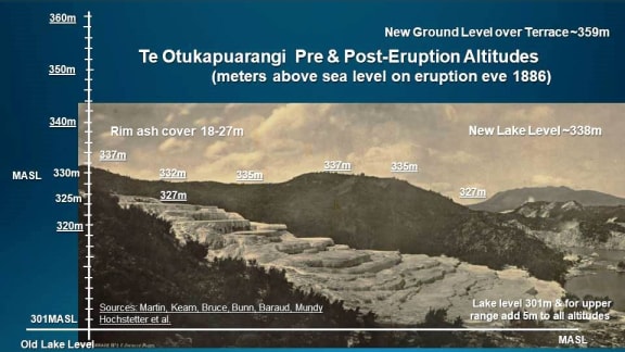

Te Otukapuarangi showing the first accurate altimetry of the Pink Terrace, measured against sea level and the old and new lake levels.
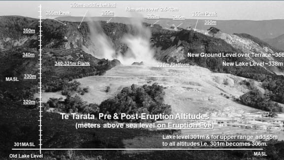

Te Tarata showing the first accurate altimetry of the White Terrace, measured against sea level and the old and new lake levels.
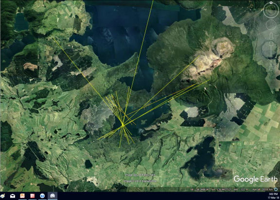

The reverse engineering of Hochstetter’s complete 13 bearing dataset in March 2018, showing his two 1859 Observation stations around the old Lake Rotomahana with optimal accuracy.
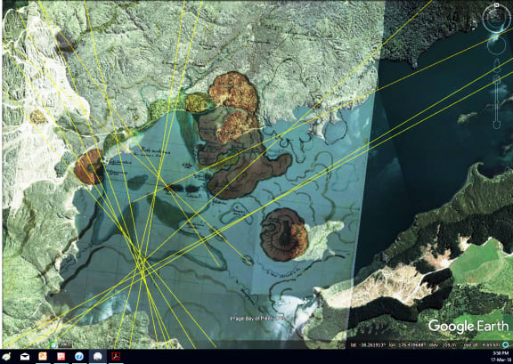

A close-up of Hochstetter’s survey bearings overlain with his method-of-squares map, showing terrace locations.
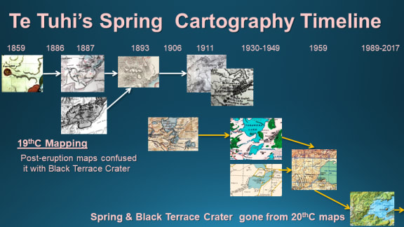

Te Tuhi’s Spring i.e. The Black Terrace, showing how it and Black Terrace Crater slipped from the map in the 20th Century.
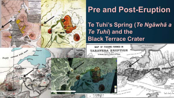

19th Century mapping of Te Tuhi’s Spring and later confusion with Black Terrace Crater.
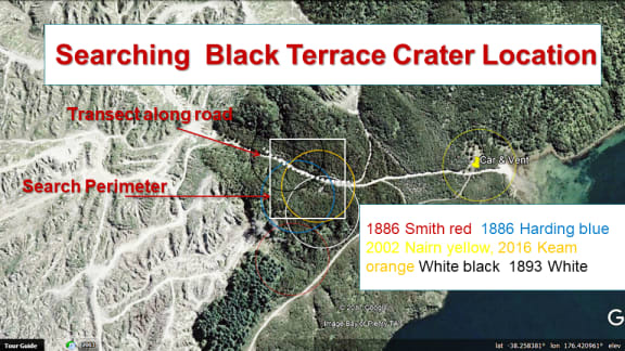

The latest search area for the Black Terrace Crater, (shown as the white square) and drawing on all previous mapping.
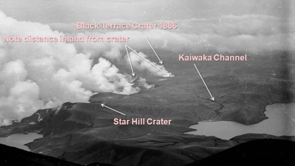

The photo the author first noted as showing Black Terrace Crater erupting and Kaiwaka Channel weeks after the main Rotomahana eruption ceased.
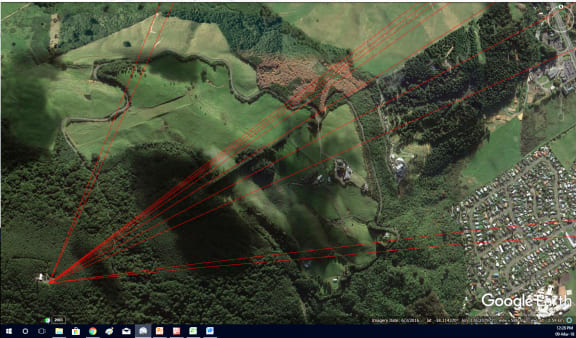

Dr Hochstetter surveyed around Rotorua and we used his Mt Ngongotaha survey to validate the accuracy of his Lake Rotomahana compass bearings. They proved accurate to within one degree.
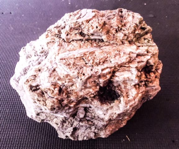

An impressive example of pink-to-white silica sinter, illustrating the colouring of the old terraces.
Researchers say they have found the final burial site of the famous Pink and White Terraces, 132 years after the Mt Tarawera eruption engulfed them. A full archaeological investigation kicked off in September, using non-invasive scanning to determine if the terraces are still intact. The data showed the terraces were next to the lake outside of the volcanic crater, according to Rex Bunn, who led the recent investigation and co-authored last year's article in the Journal of the Royal Society of New Zealand.


